
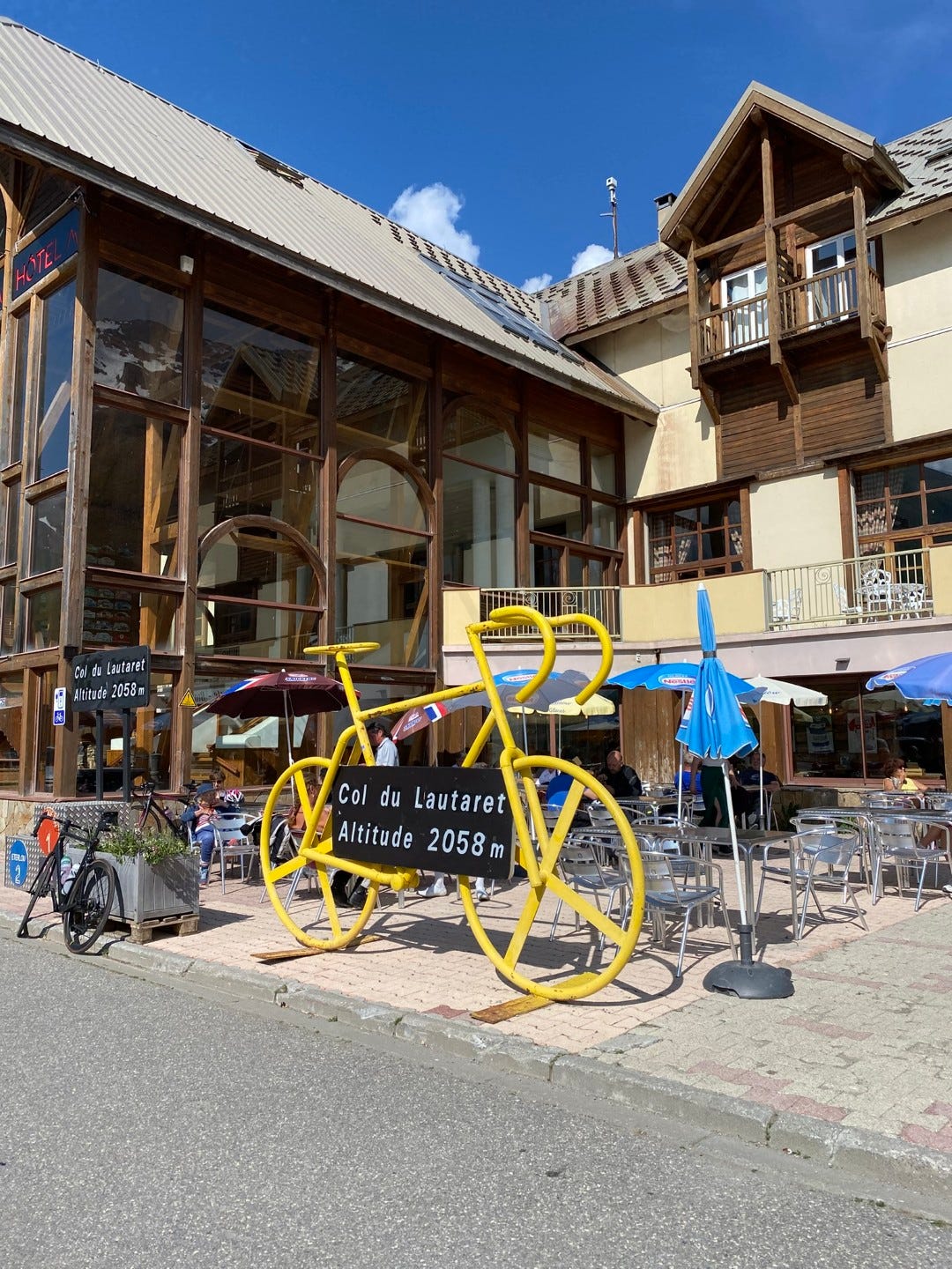
Col du Lautaret
Take a botanical hike in the Alps, in photos

I invite you to take a hike (faire une randonée) with me. It’s June in the French Alps. We’ll do a bit of botanizing and birdwatching (and marmot-spotting), but mostly gawp at mountains. And then we’ll visit an alpine botanical garden in full flower.
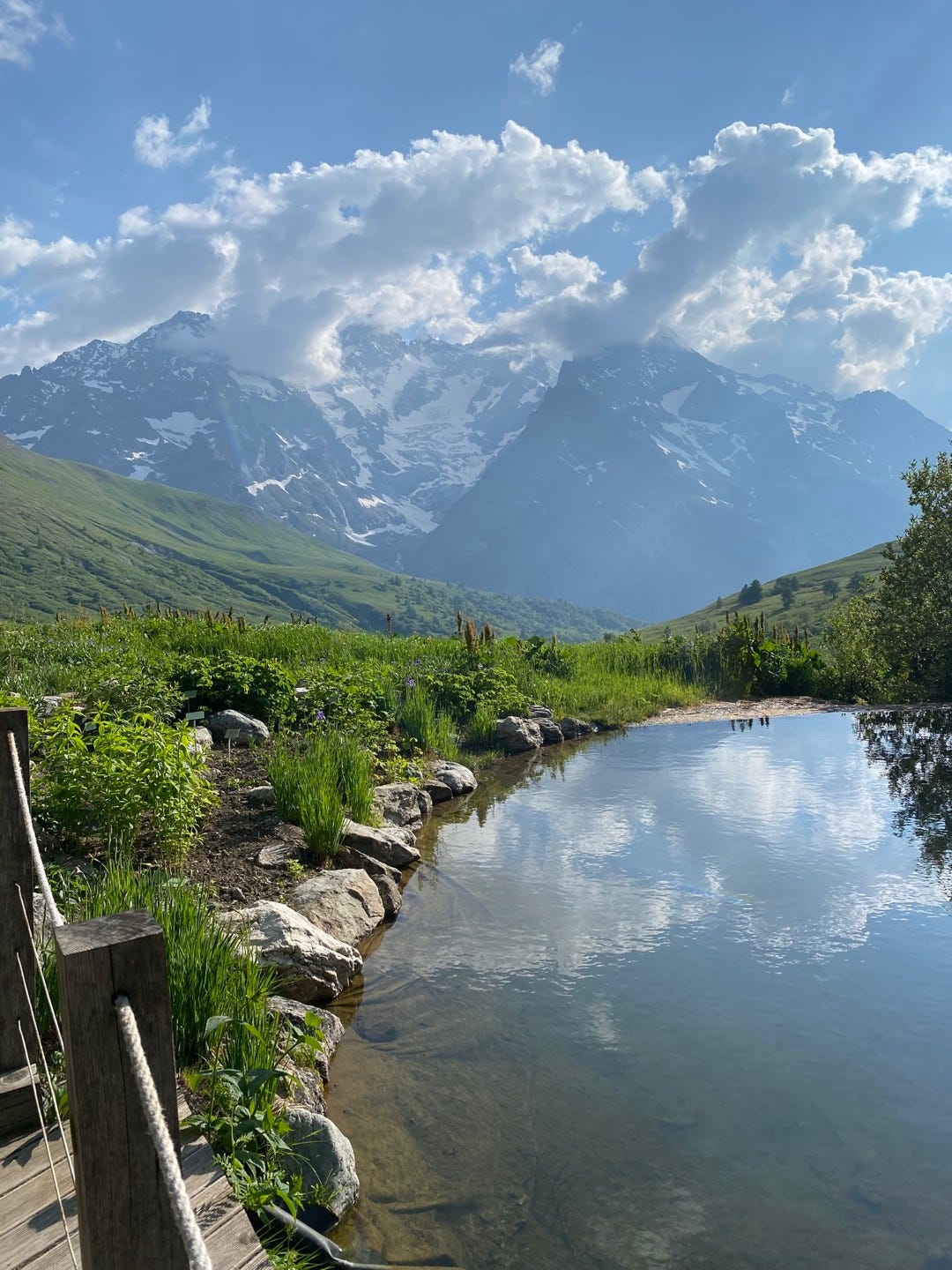
First, some background. Grenoble, the city where I live, is nicknamed the “Capitale des Alpes,” even though it’s only around 200m above sea level—a valley on the edge of the Alps more than in the Alps. But it doesn’t take much driving to be in the midst of some properly stunning mountains. In an hour and a half, you can reach one of my favorite places in the Alps (and also the world): the Col du Lautaret and its Jardin.
A col is a mountain pass. The Col du Lautaret is formed by the river valleys of the Romanche and Guisane rivers, which open a route from Grenoble via Le-Bourg-d’Oisans to Briançon, the highest city in France—a proper Alpine town. Lautaret is a heavily traveled route, leading eventually to Italy, and in the meantime connecting several ski resorts (Alpe d’Huez, Les Deux Alpes, La Grave). It’s also popular for cycling tours, including the Tour de France and the Route des Grandes Alpes.
Most importantly for me, it’s the home of the Jardin du Lautaret, an alpine botanical garden and research station managed by the University of Grenoble Alpes. The Jardin is a field base for the Laboratoire d’Ecologie Alpine, and as a member of the lab I’ve been lucky enough to visit a few times each year for fieldwork and lab retreats. I’ve written several posts already about the Jardin and our work there, including my first winter and summer visits to the garden and the nearby glaciers, autumn fieldwork at Lautaret, and the wonders of Alpine winter.

I will pause here to recommend taking a gander at these other posts for more context and photos of the Col du Lautaret, also linked at the end of this post in case you still haven’t fully satiated your appetite for flowers and mountains.


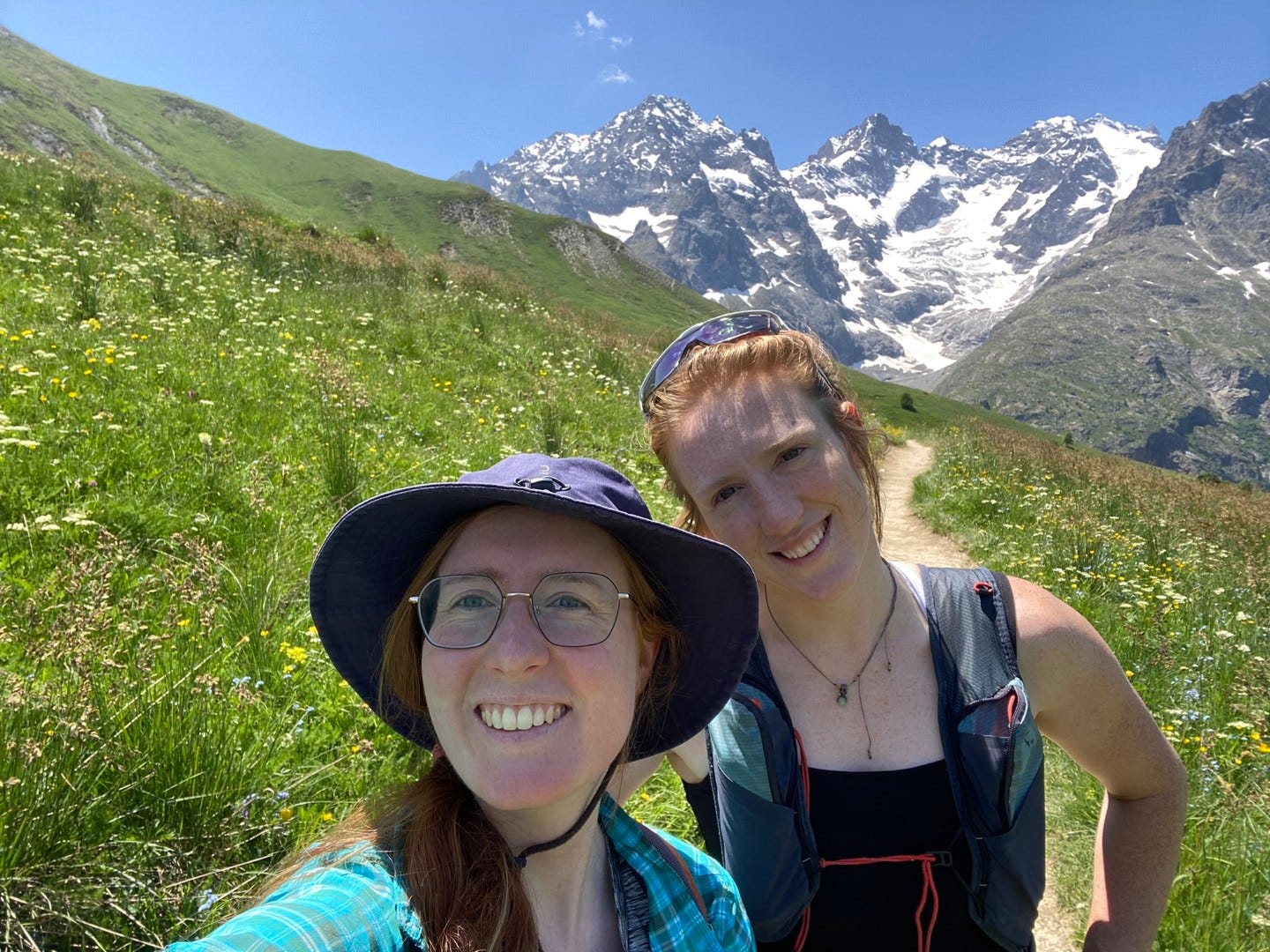
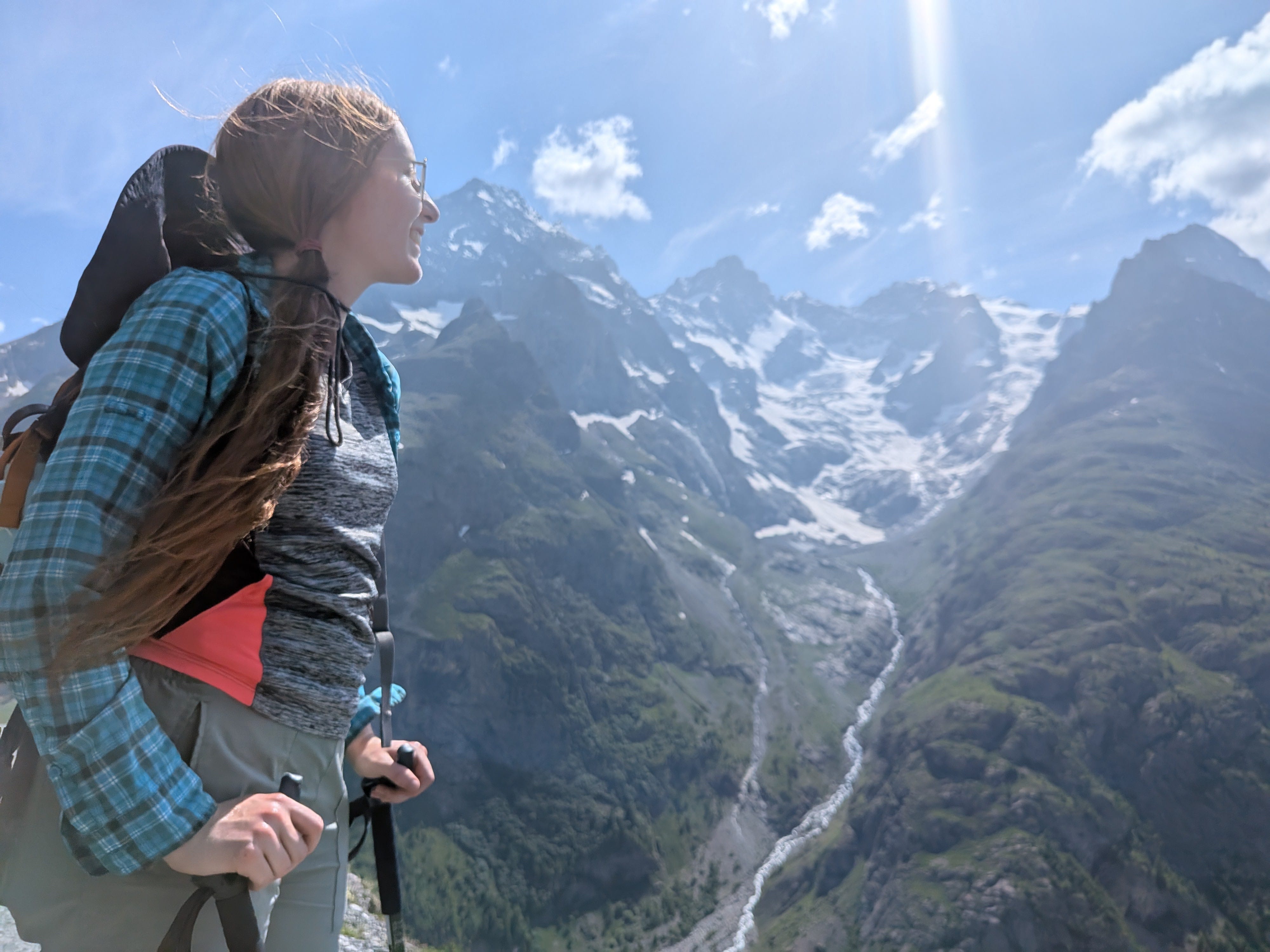
The Jardin du Lautaret is one of the first places I think of taking friends when they visit. I’m also collecting seasons there, and for a while only had winter, late summer, and autumn. So when Erika, my good friend (and doppleganger) from PhD days, finally comes to visit me in June, it’s a perfect opportunity to visit the Jardin during Alpine spring. Not only to check up on the flowers (and escape the valley heat wave), but also to try a new hike while we’re up there.
And of course, you’re invited too.
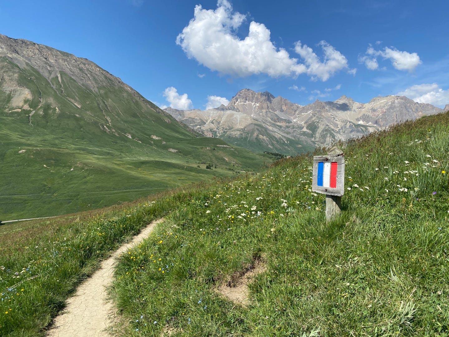
The Sentier des Crevasses
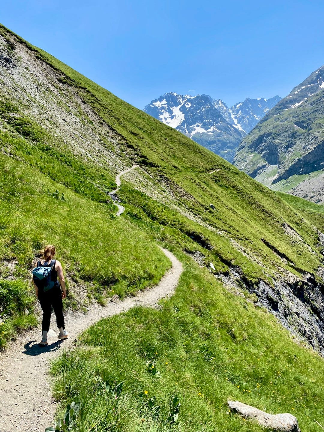
Col du Lautaret is both a route and its highest point. You can catch a ride1 and ask to be dropped off at the Col du Lautaret, which is essentially an outpost—a few restaurants, a souvenir shop, a hotel, and a parking lot—for cyclists and motorists. From here, you can walk a few minutes upslope and arrive at the Jardin du Lautaret. Or you can cross the road and find a trailhead leading into the heart of Ecrins National Park.
Saving the Jardin for the evening (and for the end of this post), we take the trail: the Sentier des Crevasses. So-named, I presume, because parts of the trail skim the flanks of mountainsides above steep valleys of slate and cascading streams.
But we’ll get there.
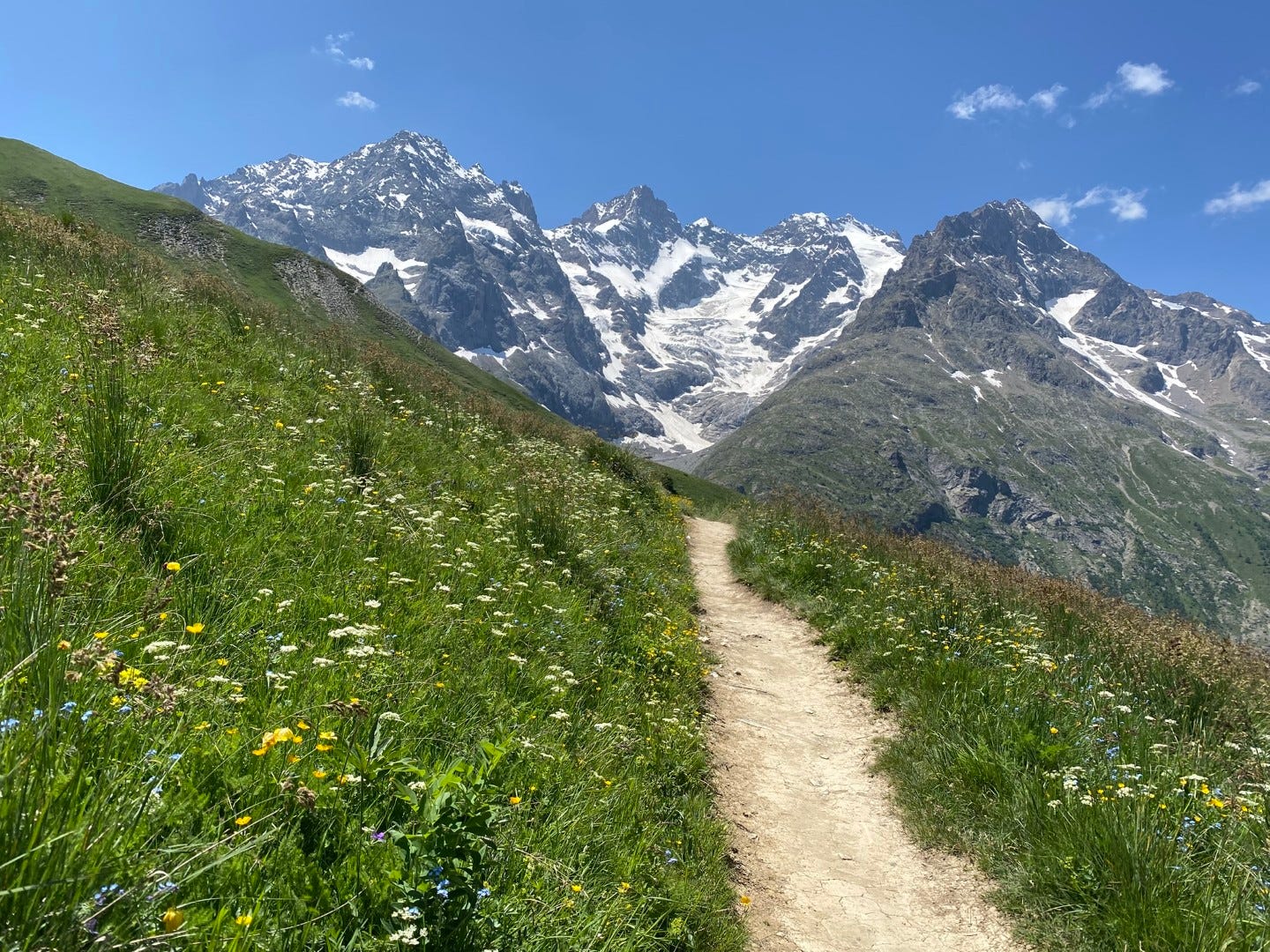
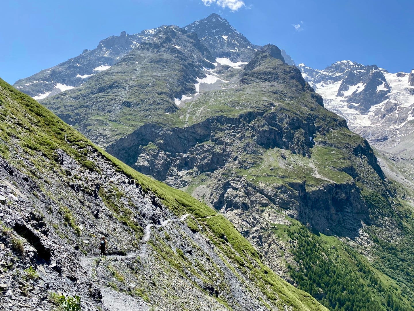
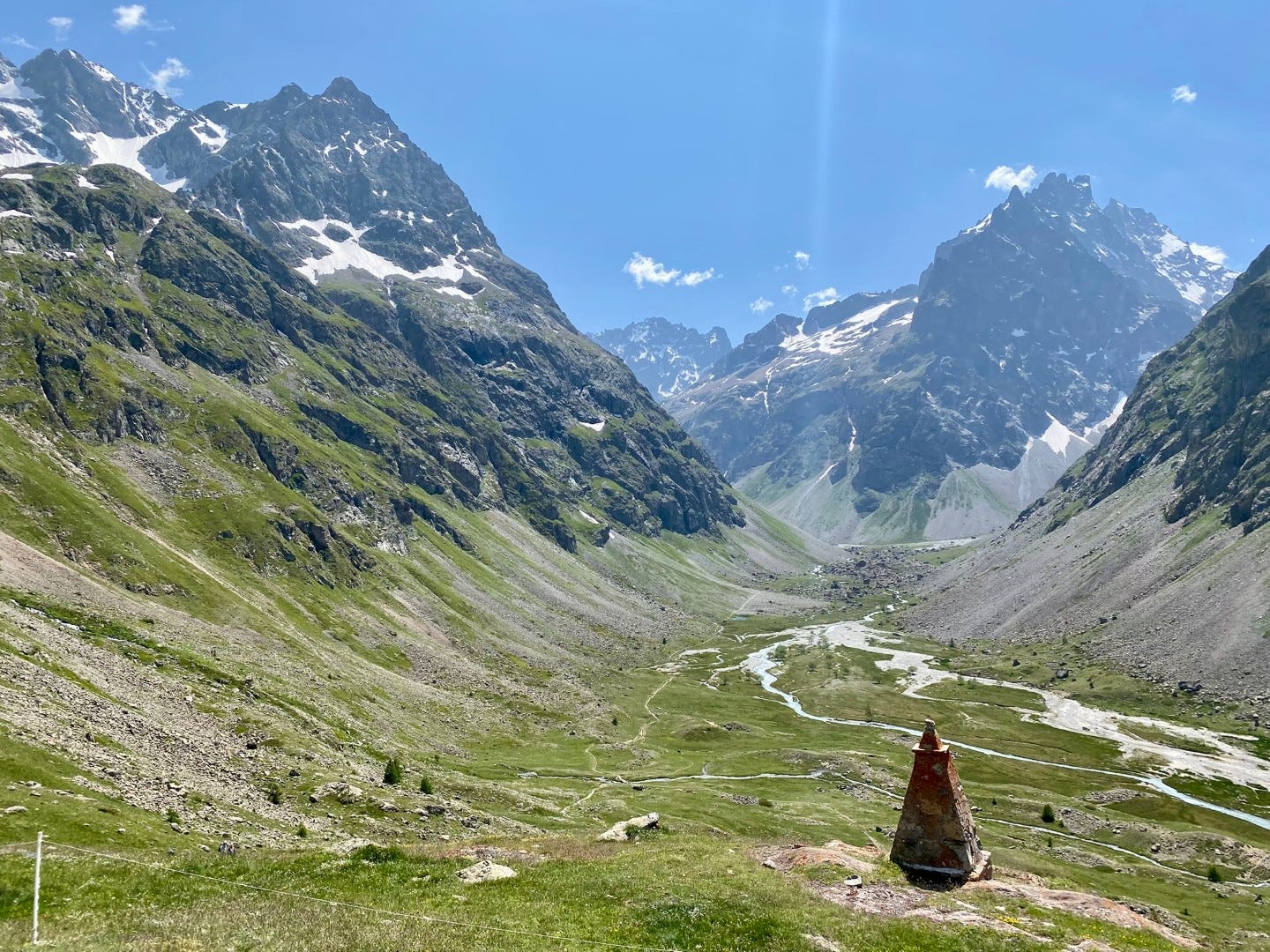
We’re starting here.
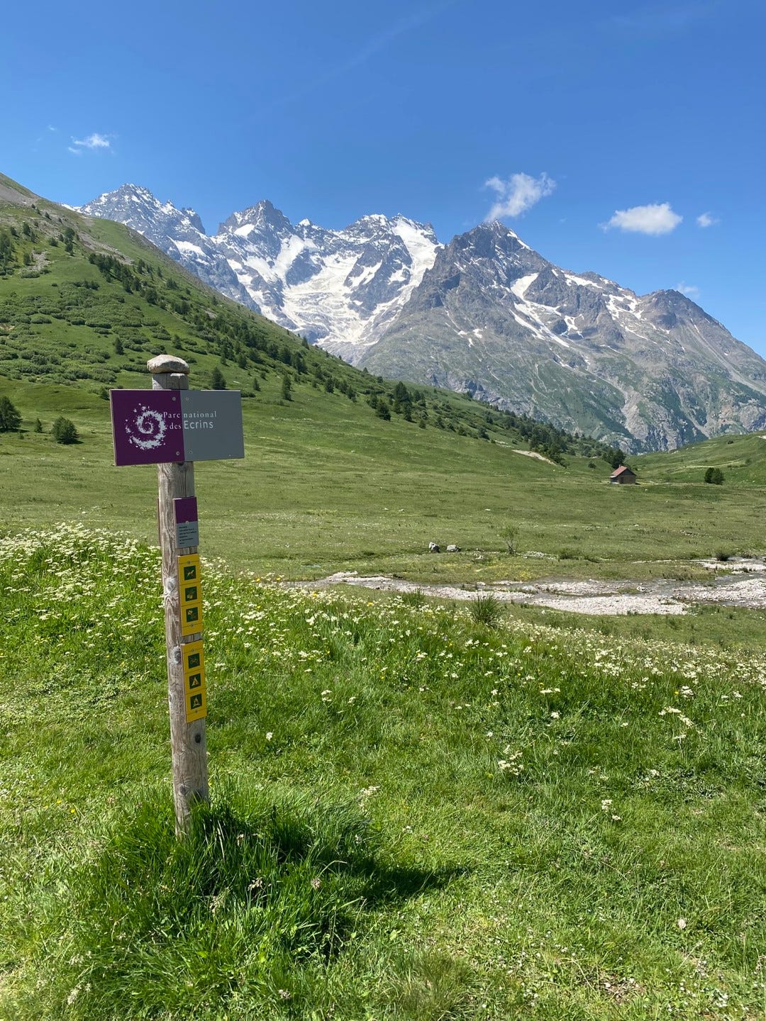
On the sign at the trailhead is the swirly purple logo of the French National Park system (which I wrote more about here). We’re now leaving the buffer zone around Ecrins and entering the heart of the park. On the horizon, we’re looking at La Meije, one of the crown jewels of the Ecrins, and several of its glaciers.
The meadows
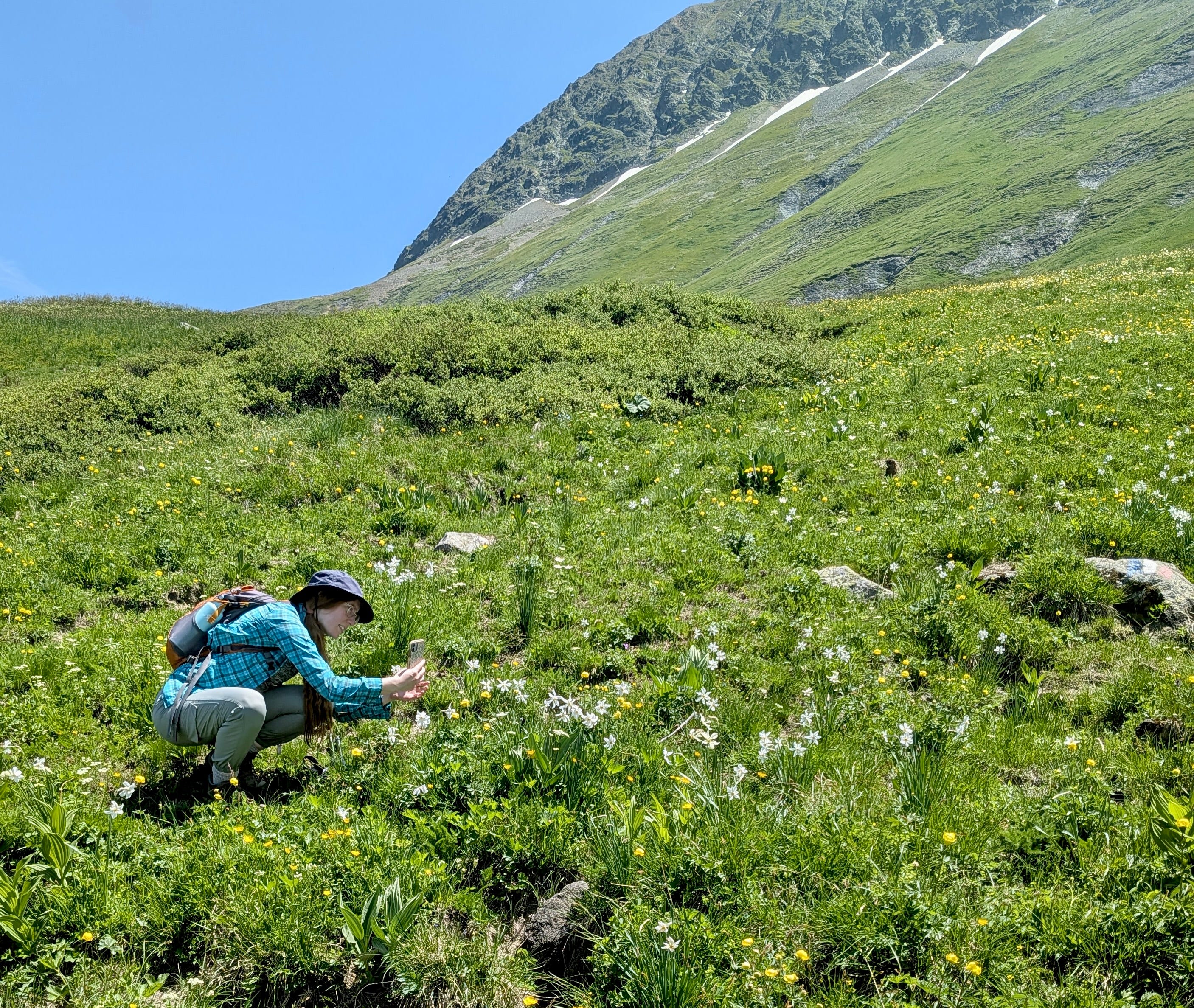
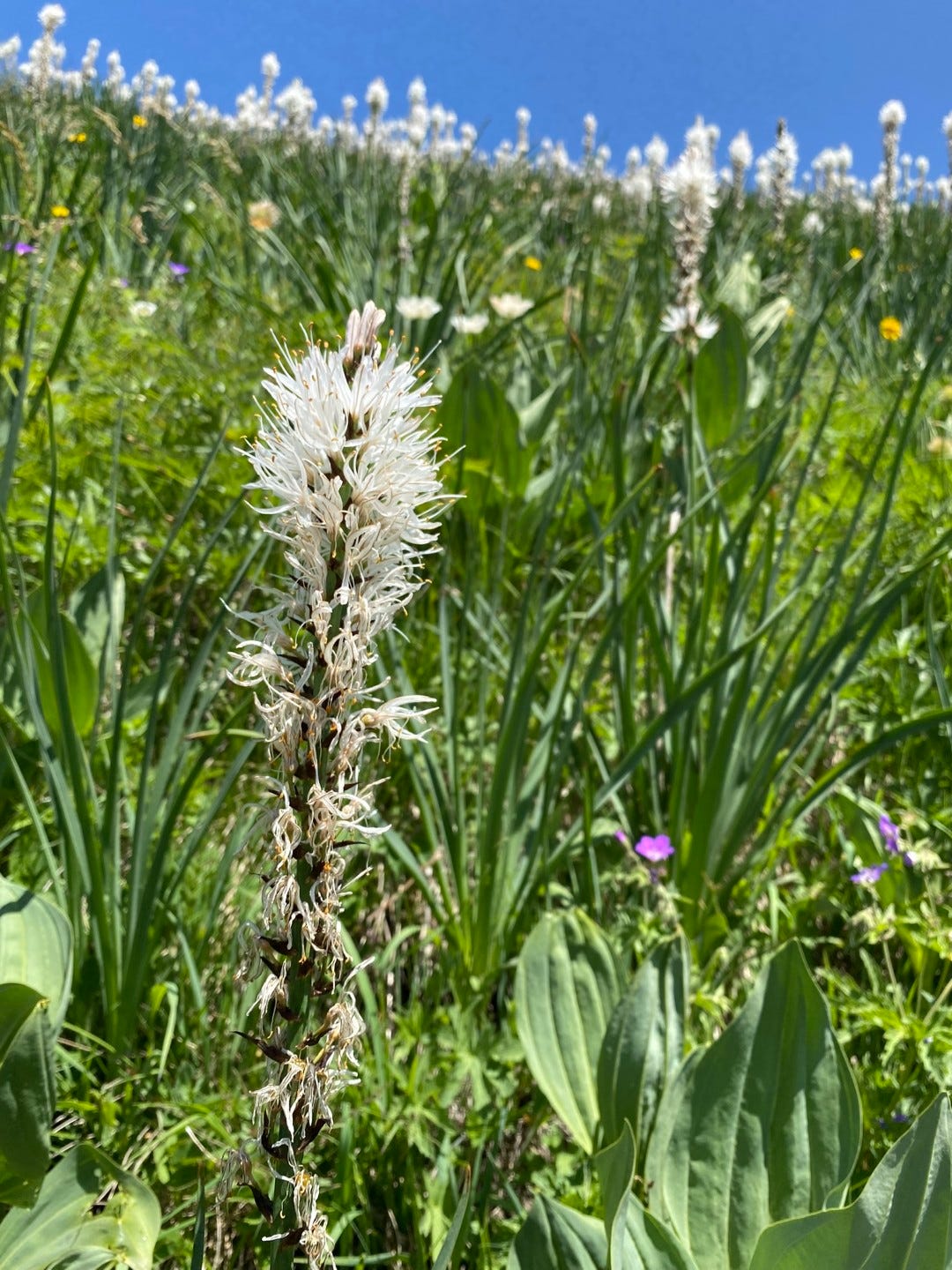
The first few kilometers of the hike ramble pastorally through meadow and leafy beds of riparian shrubs. I pause often to document flowers with out-of-focus phone pics. When I’m not falling behind we talk about books and the ups and downs of academia.
Butterflies weave between flowers and path; grass fringes everything. Skylarks sing their sparkly broadcasts up in the air; water pipits flash about in the undergrowth, piping. There’s one very vocal bird skulking loquaciously but invisibly in the interiors of shrubs, probably a marsh warbler.
(Ignore my comment about the app not getting it. It eventually did.)


Above the Romanche
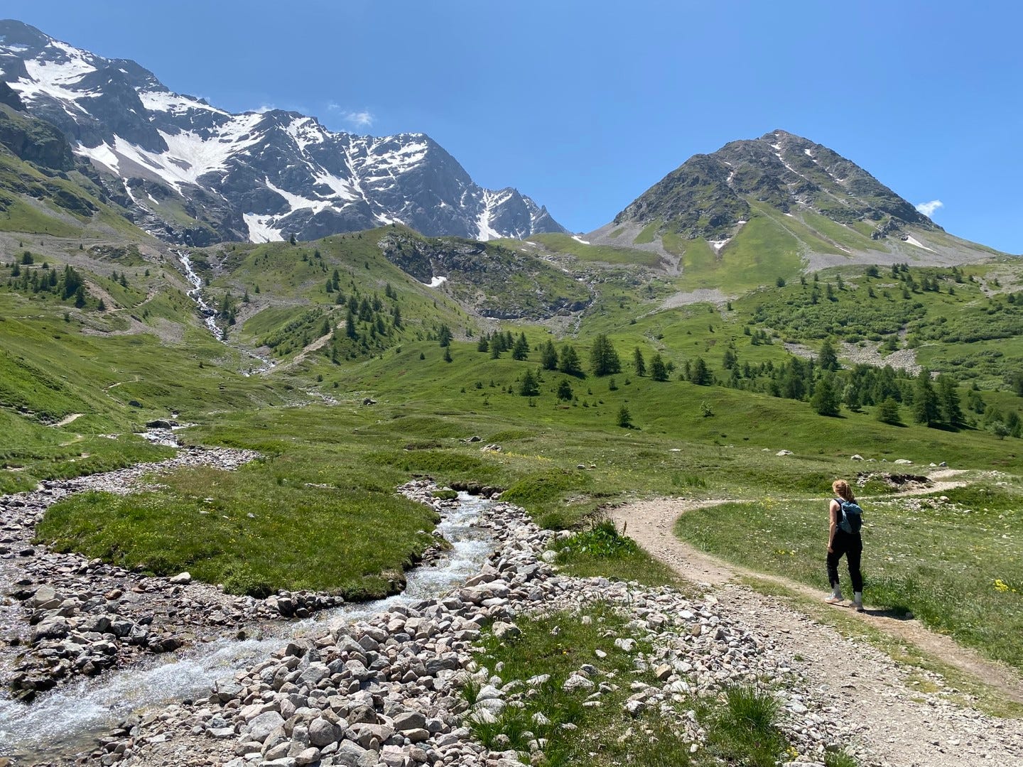
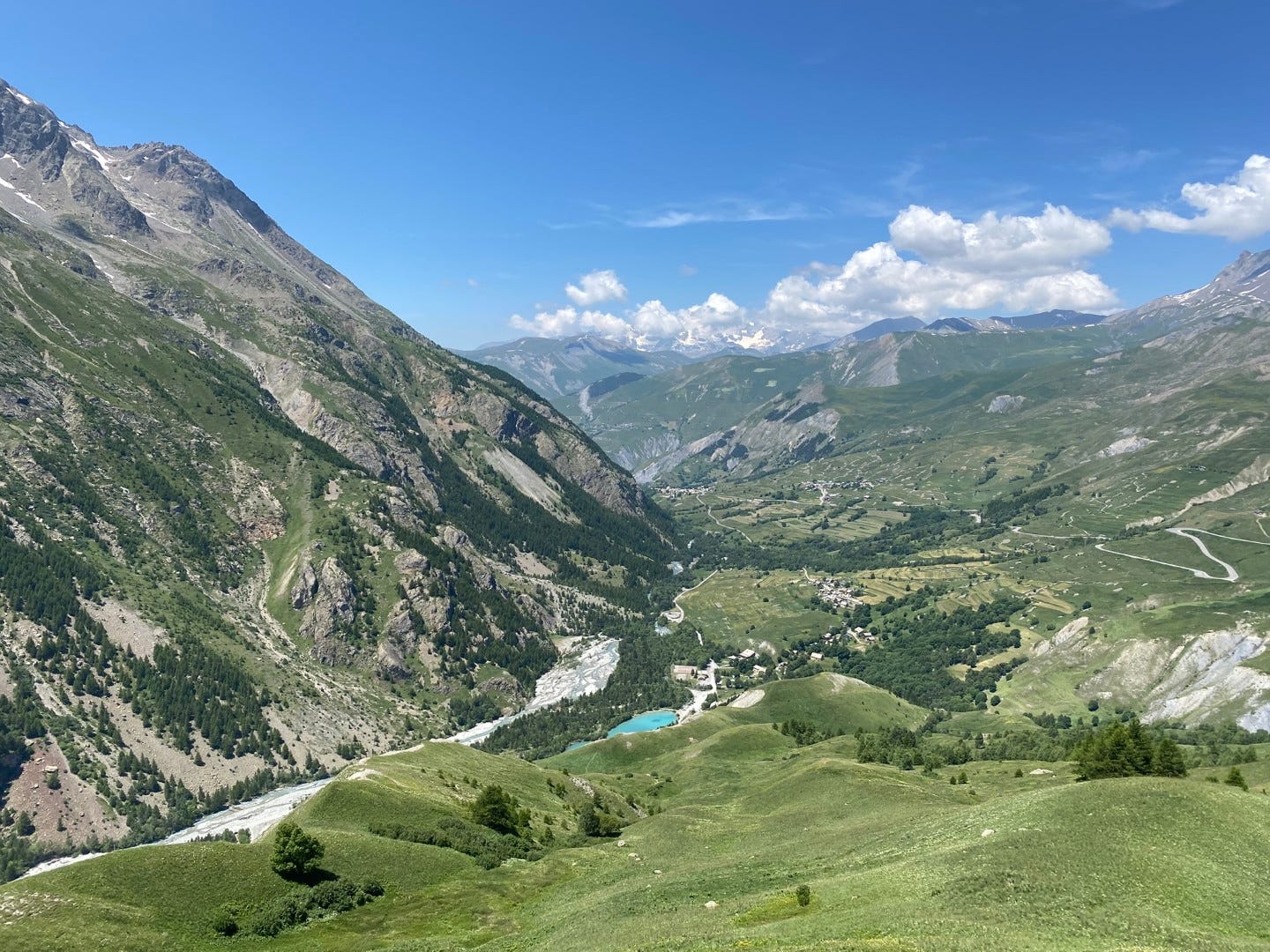
Eventually the path begins to turn a corner, and the slope begins to fall away below us, and we’re skimming the Romanche River valley as it bends away from the Col du Lautaret. Looking down and back, we can see an opal of a reservoir beside the river’s braided bed. Looking up and ahead, the mountain panorama is shifting; we begin to face the Pointe Piaget and the Pic Gaspard, who flank La Meije, and across the Romanche valley, the Pic de Chamoissière, and maybe, behind it, the tip of massive Barre des Ecrins. Disclaimer: I could be wrong about any of this.
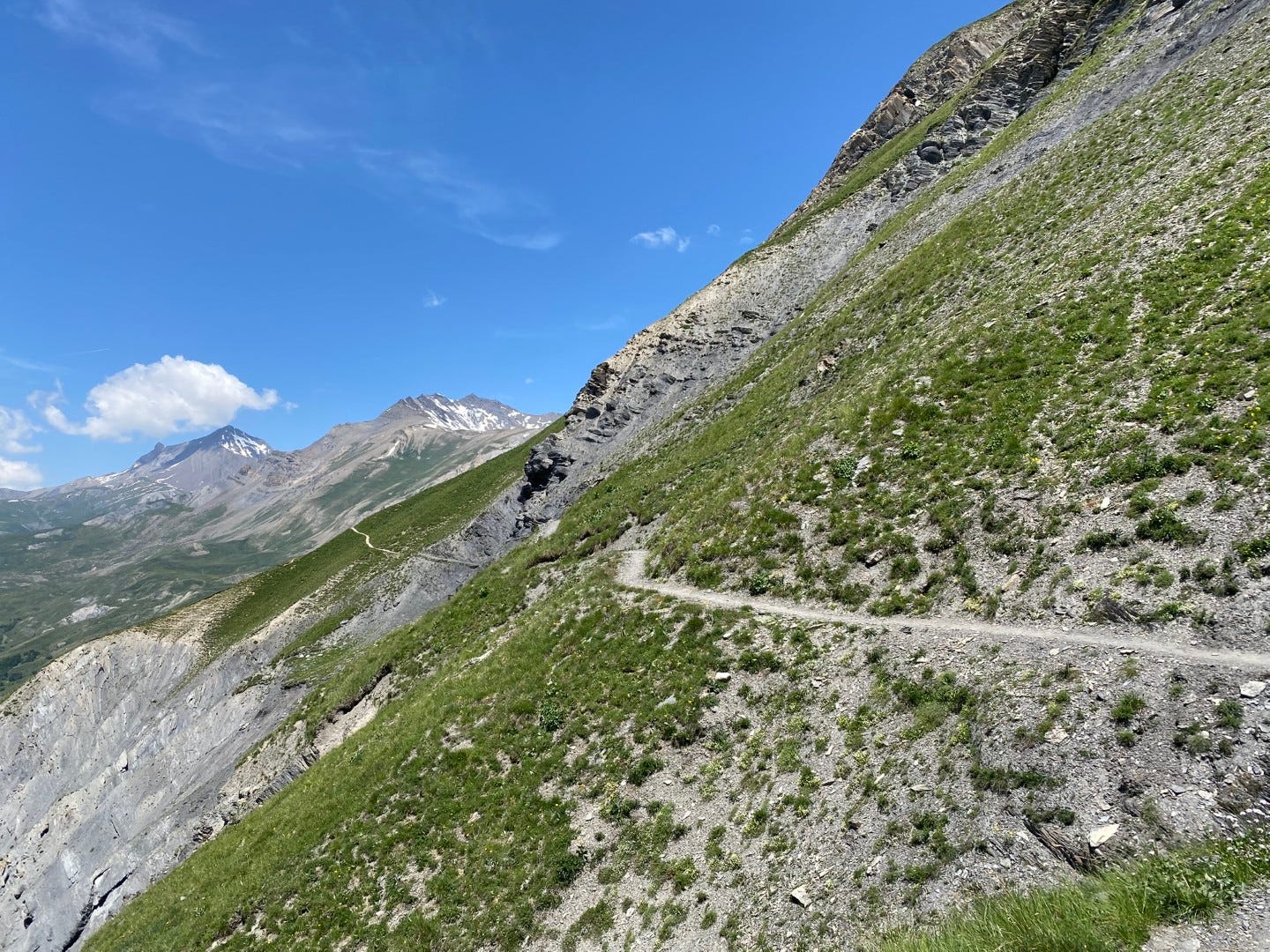
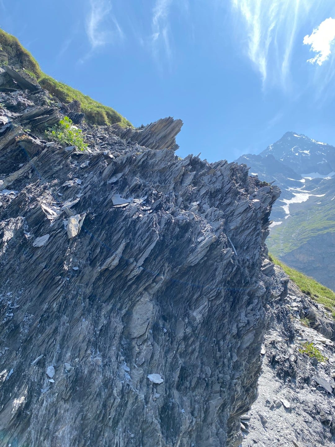
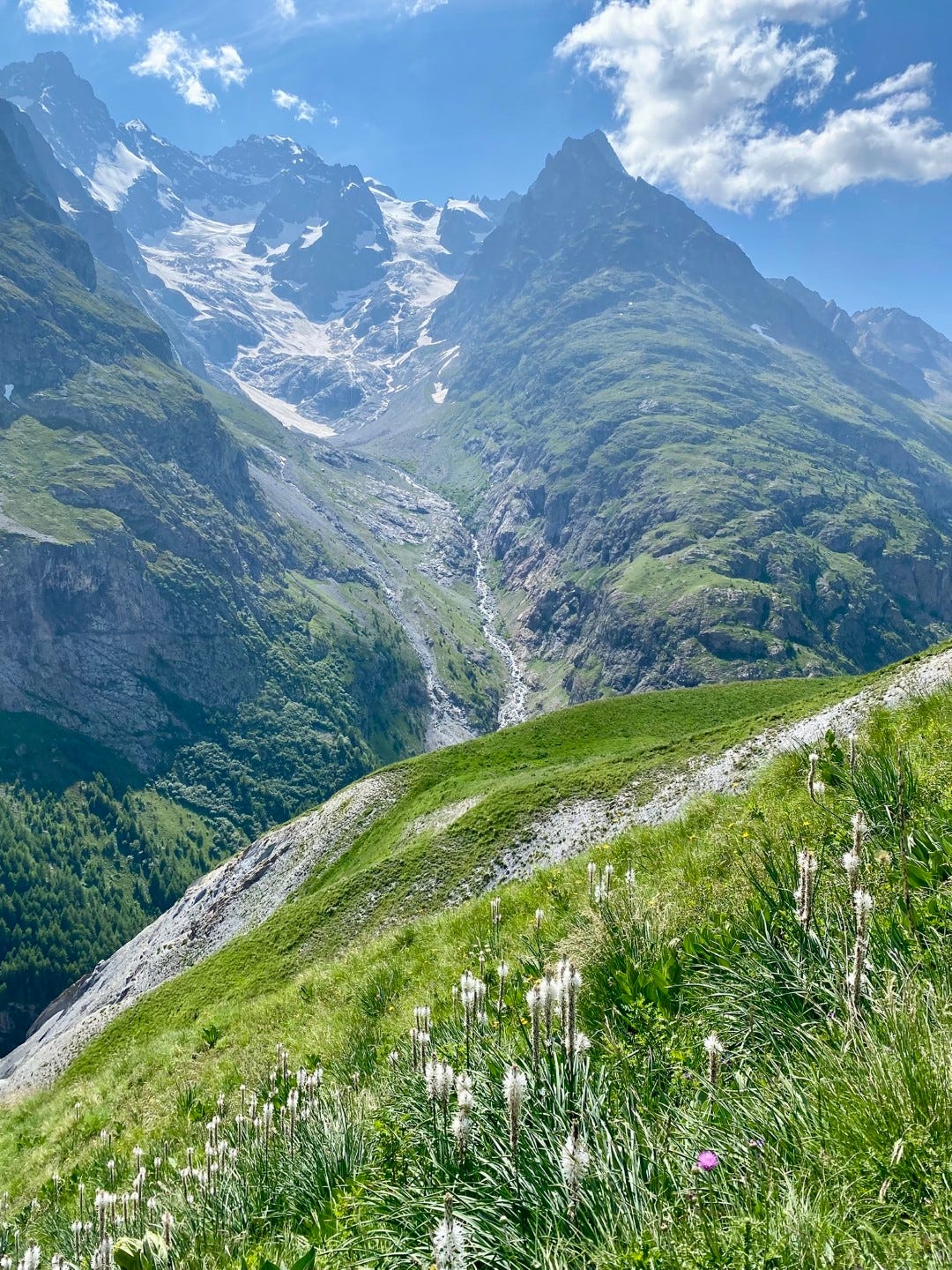
We will pass through one slip of slate where erosion is gouging out the mountainside, but the main slate zone is still to come. In the meantime there is more alpine meadow, and the biggest patch of white asphodel I’ve ever seen. Meanwhile, marmots converse on the path ahead.
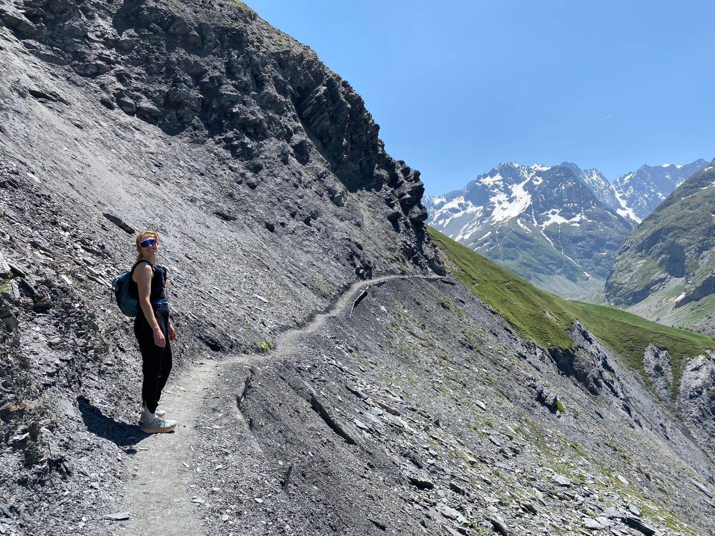
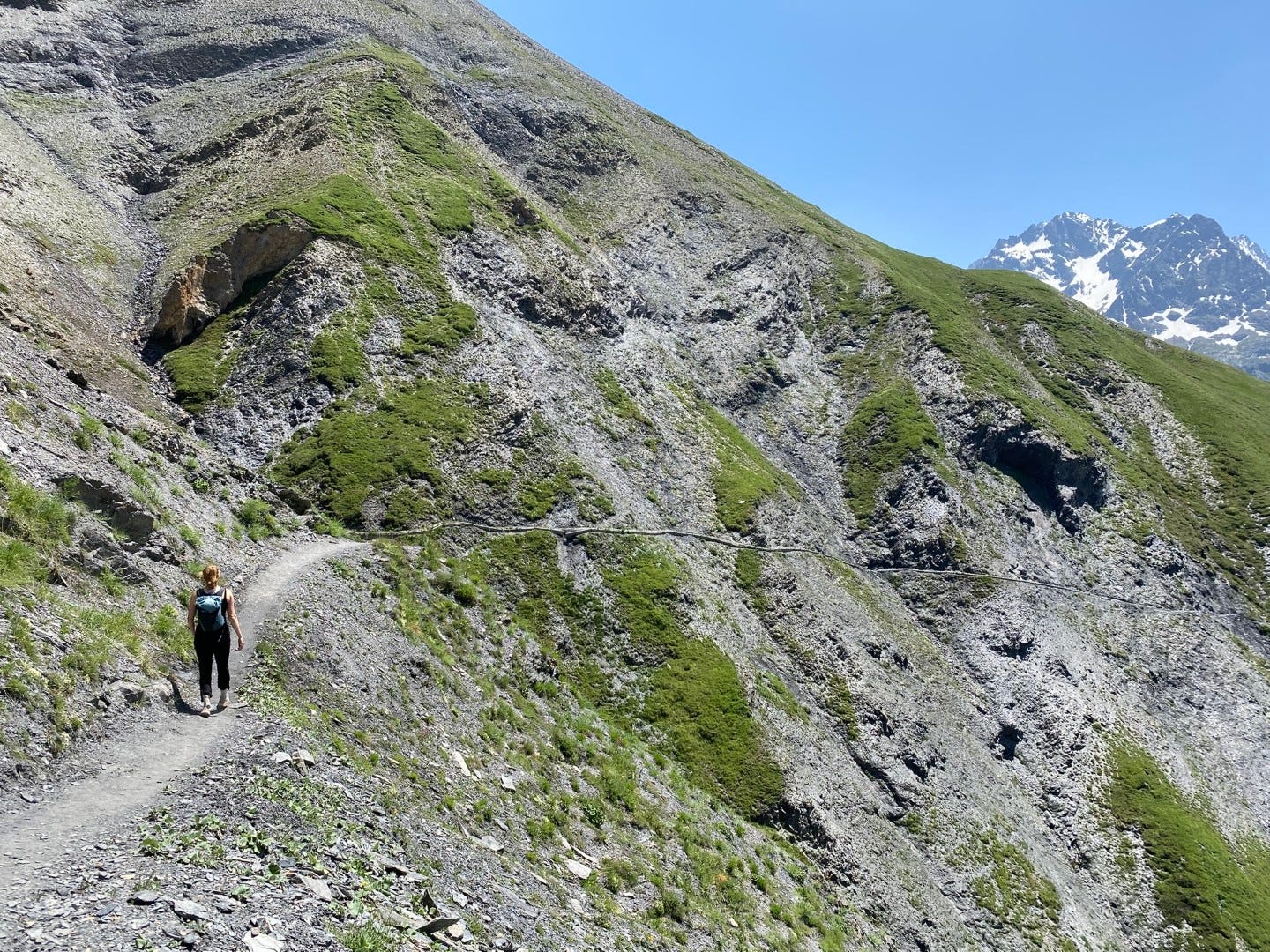
Slate vertigo
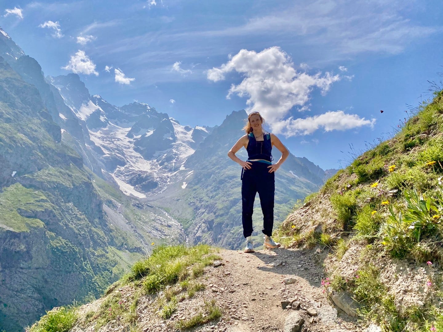
Soon, our head for heights on a crumbling, eked-out trail is truly tested. I’m not one for vertigo, and the slope isn’t that steep; if anything the piles of slate2 would be something of a cusion. But still, seeing the under-girding ties and bolts sagging away here and there isn’t particularly comforting. The trail was rebuilt in the last decade after washing out, and I can see this happening again in the not so distant future. This is actively eroding mountainside.
The oxidizing stream we pick our way across is another testament to gravity.


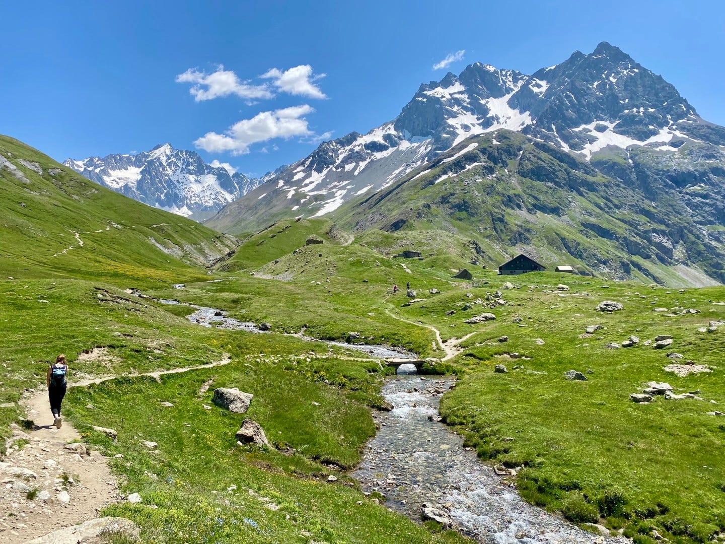
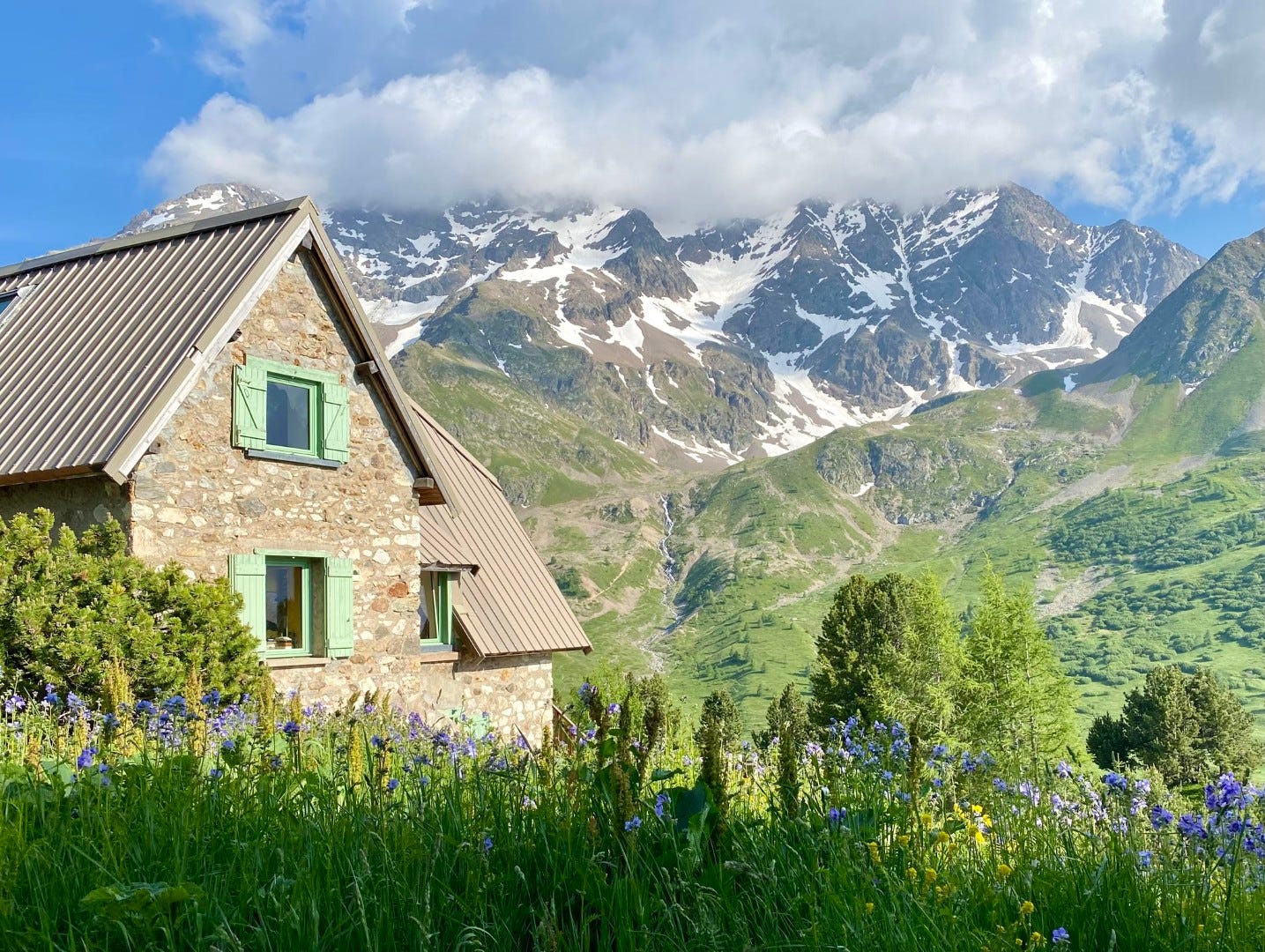
The Refuge de l’Alpe de Villar d'Arène
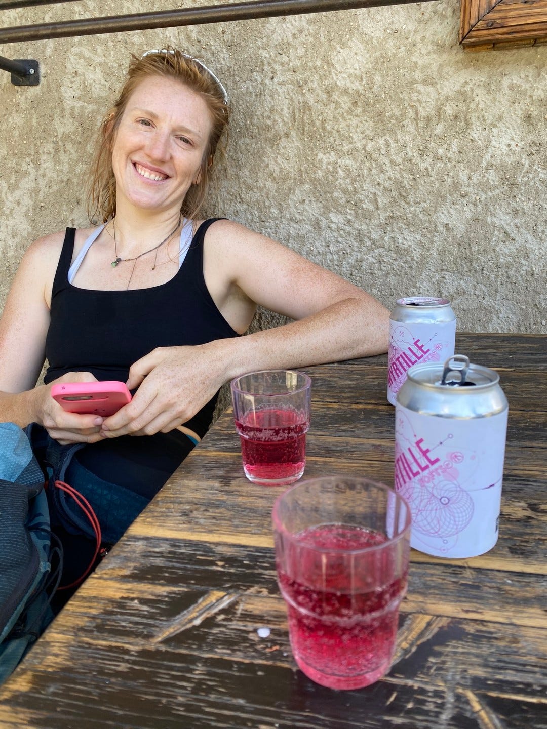
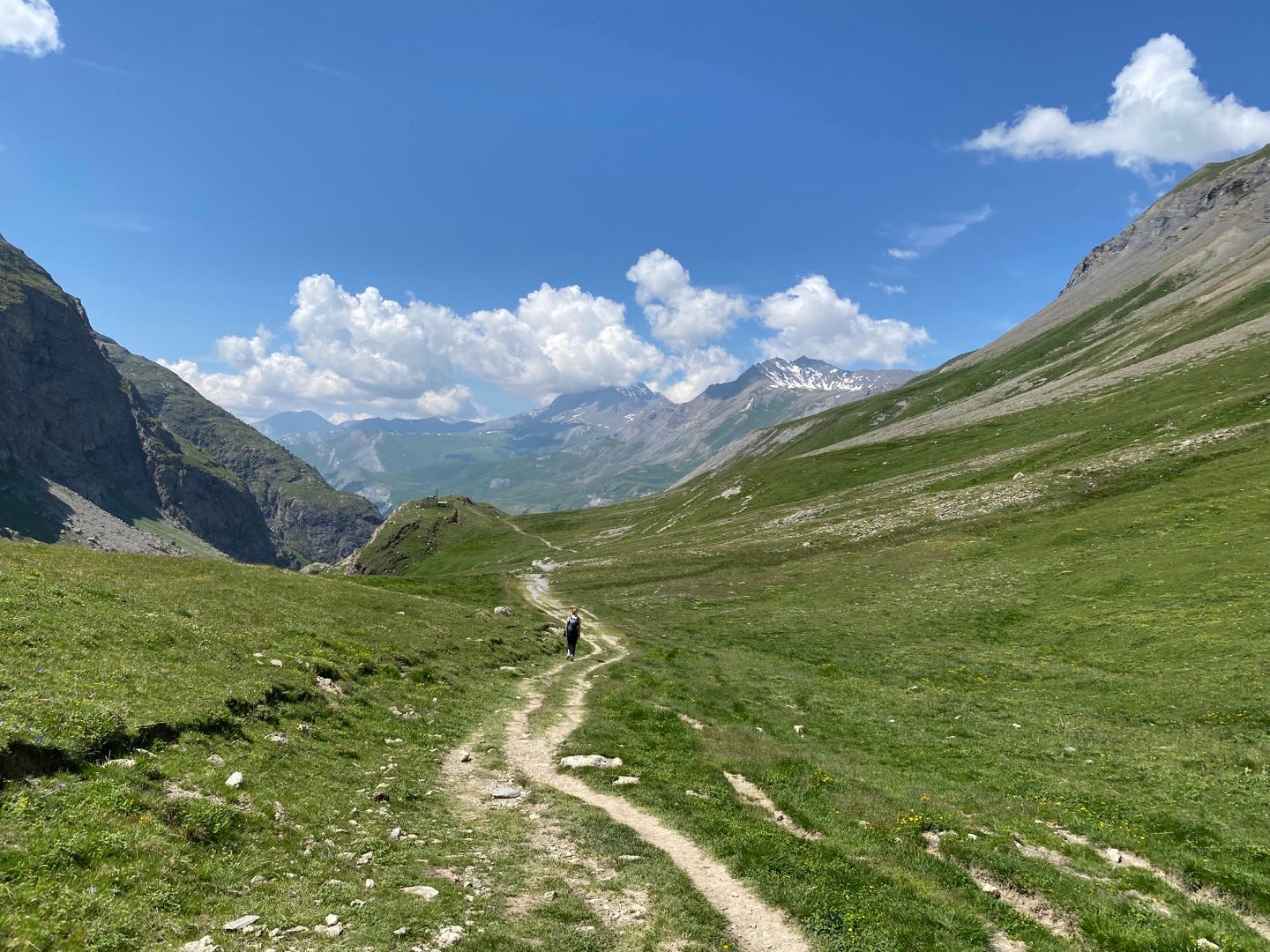
The path begins to descend into the valley. Before long we’re in paradise itself, approaching our destination: the nearest refuge, or mountain hut/bunkhouse where hikers can stay overnight or just stop to buy drinks and cheesy dishes. We sit on the deck with some blueberry limonade and our packed lunch, and continue to not get over the mountains and grass and valley and streams in our company.
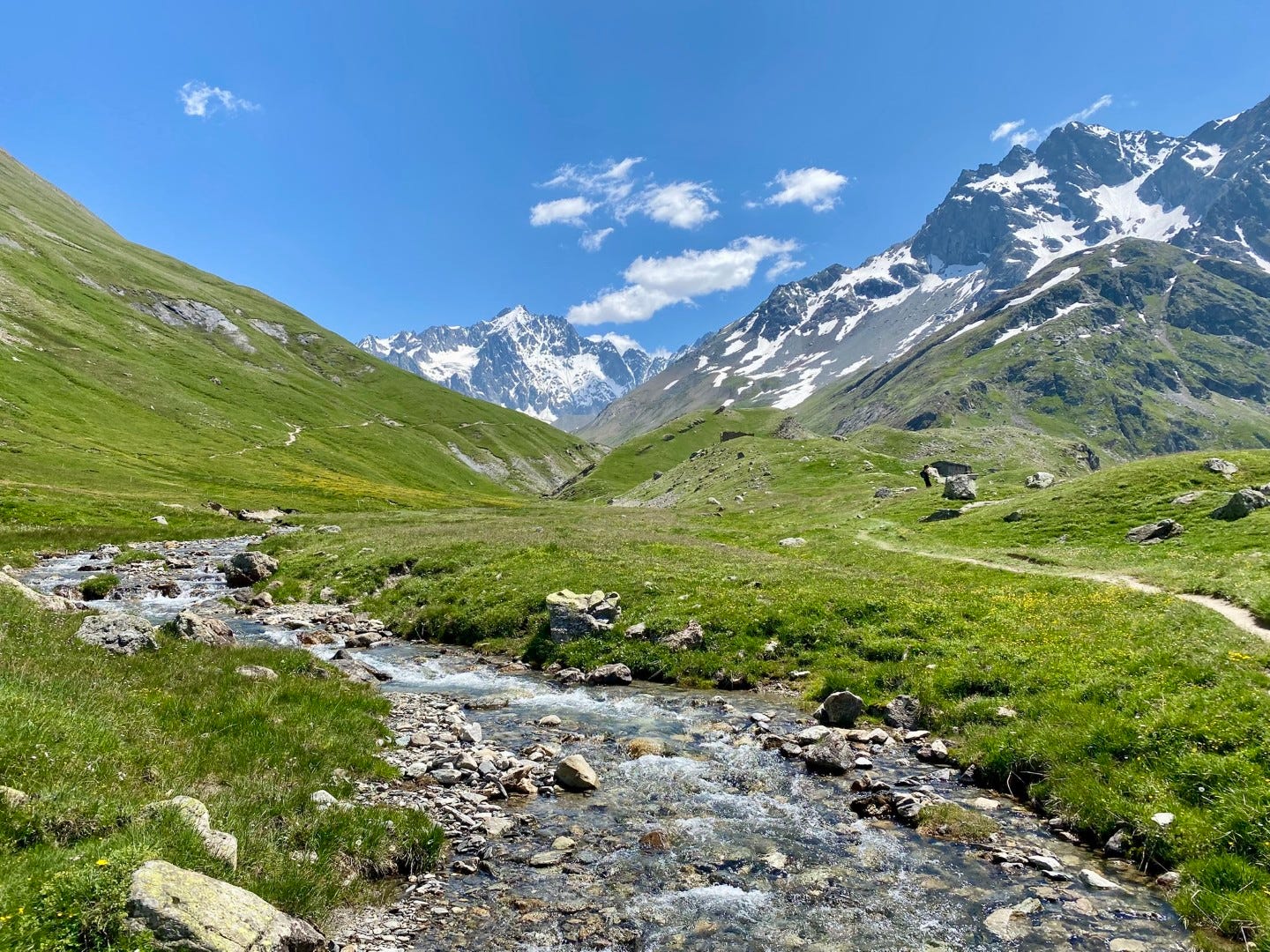
If we had started earlier, we could have easily continued another few kilometers to the glacial lake and its gravelly moonscape of glacier (Glacier d’Arsine) at the top of a nearby tributary valley, but we still want to get back to the Jardin before evening.
Heading back
We go back the way we came, through rippling valley grass populated with fat ambling marmots and their boulders, and northern wheatears flashing their creamy bellies and black wings and masks between them. We recross the slate slips without incident. We pose a few more times with La Meije. We round the bend again toward the Col du Lautaret, coming to face Le Grand Galibier keeping watch over it.
Video: Marmot in paradise


And we are back at the Col’s watering hole for a souvenir and a drink.

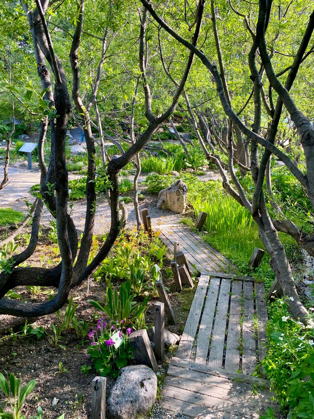
The Jardin du Lautaret
Finally, we head to the Jardin. It just so happens that a few of my colleagues are here on fieldwork, so we stop by one of the field station’s chalets to say hi before sneaking into the garden just after closing time.
It’s the exact right time of day. The light is slanting and gilding, filling the white petals of anemones with angel glory, touching off the rainbow of alpine flowers representing all corners of the world’s mountains.
We wander the winding paths like monks, basking in it all.


It’s cliché to say, but it was indeed the perfect end to a perfect day.

For more Lautaret:
The garden and the glacier

Winter: The first time I set foot in the Jardin du Lautaret, it was buried under a blanket of snow. Here and there I could see botanical plaques poking up from exposed slopes, but the carefully curated terraces of alpine plants from around the world were dormant. It was March and we were at 2100 meters.
Visions from the field: Three days in the Alps

We only had one plot left to sample that last morning, but there was a mid-morning seminar someone wanted to get to back in Grenoble. Out of bed before dawn, then, and up the mountain road from the Lautaret field station before sunrise. After the third or fourth switchback, the vision came through the van window, slurred with condensation though it was: the sea in the valley below us.
A meditation on Alpine snow

At the tail end of my first winter here, I had the chance to reacquaint myself with the staggering, perilous, humbling prospect of snow. For three days, I stepped out of the pink and green and gold of unfurling spring in the valley and plunged into the drifts of alpine winter at 2100 meters.
We used a ridesharing app (BlaBlaCar) because the bus from Grenoble doesn’t run often enough for a day trip. We didn’t have a ride back arranged yet when we went up, thinking we might have to hitchhike back to Grenoble…which is pretty normal on this route, but would have been a first for me. A ride turned up on the app in the end, though.
I’m calling it slate, could be shale, or schist, or something else…
This is absolutely amazing! What a stunning place to go for a hike. Thank you for taking us with you!
Still worrying it'll all be over when I get to the Vanoise next month! Infogeol app quite good for underlying rock types though less user friendly than the UK equivalent. Would guess your slippy stuff is shale. (I did some schist shale slate mansplaining but then deleted it as being boring)